Sunday, February 28, 2016

2016 hike 7: Joshua Tree National Park

This weekend, I am taking a break from walking up hills or in the desert. It is the first break since the new year. I do have some time now to write up this blog about our adventure in Southern California. I also made time to pack my backpack for next weekend's trip to Wild Cat campground on the Point Reyes peninsula.

Last weekend, we made the seven and a half hour drive from the Bay Area to Palm Spring and Joshua Tree National Park. I did not know much about this park. It doesn't seem to be very popular among my friends or family either. Only the rock climber type among them has visited the park.

We entered the park from Yucca Valley, and drove the Alta Loma Drive to the West Entrance Station. In doing so, we completely missed the Joshua Tree Visitor Center. Nevertheless, the rangers at the station were very helpful to point us in the right direction.


Road to the Cholla Cactus Garden
We stayed one day in the park and were able to see quite a few things. However, it is worthwhile to come back one time and actually sleep in the park. There are many campgrounds all over the park.
  • We posed along many Joshua Trees. Duh. 
  • We hiked the nature trail in the Hidden Valley. 
  • We hike to the Barker Dam, which still had some water in it. 
  • We snapped pictures of some many rock formations, including Skull Rock. Almost all the rocks give you the impression as if they were piled up by some giant. However as the geology guide explained, they were formed due to cracks during the cooling of molten granite and erosion. 
  • We walked among the cacti in the Cholla Cactus garden. 
  • We saw the sunset over looking Coachella Valley from Keys View at 5185ft. 
Joshua Trees, near Hidden Valley
Cholla Cactus
Skull Rock

Joshua Tree


Barker Dam


Coachella Valley, from Keys View. In the distance you could see the Salton Sea

I hope to visit and camp in Joshua Tree in the future. Spring is a great time as the weather is not too hot yet. 

Monday, February 15, 2016

2016 hike 6: Rancho San Antonio

Today's hike was a part repeat of a December hike. This time I was joined by my wife. Following the lower meadow trail, we hiked to Deer Hollow Farm at Rancho San Antonio. We returned via the Coyote trail. It was a short hike.


Sunday, February 07, 2016

Stop the bicycle ghostrider


Dear San Jose city council and SJPD, 

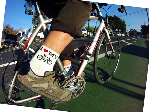
Over the last few year, you provided us with many new bicycle lanes. You even painted entire sections of the street green to clearly mark these bicycle lanes. Cars sometimes had to give up an entire lane, allowing a buffer space between cars and cyclists. I love that our city is more bicycle friendly. As I cyclist, I appreciate it.  

But yet, something is not working. Too often do I see cyclists ride against traffic. This is hazardous for me, as a cyclist, who now needs to share my lane with oncoming bicycle traffic. Worse, it is also dangerous for the car driver. Yes, you need to be aware that danger could come from all directions. However, there should be general expectation that people traveling on the right side of the road, are all going in the same direction. 

Today, in the short time I was on the road, I counted three such bozos going against traffic. 

I wonder if the problem is that there aren't enough safe crossings. As a result, a cyclist may prefer to stay on the side they started. Surely, SJPD isn't doing enough to police this type of behavior. There may be other reasons. I encourage you to look into what can be done to keep it safe for cyclists and cars. 

A concerned bicyclist, and car owner. 

2016 hike 5: Alviso Slough Trail

South of Highway 237 is busy Silicon Valley. Marvell, Arista Networks, Samsung Semiconductor, Brocade and KLA Tencor all have big buildings here. From the highway, you can also see the brand new Levi's stadium, home to the San Francisco 49ers NFL team. This weekend it is also home to Superbowl 50. Santa Clara police blocked have various street. Big party venues have been erected in the stadium parking lot. And lots of #sb50 events are going on this weekend, all over the bay area.


I opted to leave the busy valley behind and went for a hike along the bay. North of Highway 237 is the small town of Alviso (wiki). The town is part of the city of San Jose. Steamboats once arrived at New Chicago port.

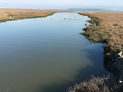
I started my hike of the levees of the Alviso marshes and salt ponds in the Alviso Marine County Park. You can still clearly see the hangars at Moffett airfield, the tent-shaped Shoreline concert venue and the big buildings of Silicon Valley. But yet, you feel far away from it all. It is quiet here. There are few hikers. Yet, there are tons of birds. Only occasionally do you hear the engines of a small boat of fishermen or the horn from the Amtrak train heading to Oakland.


The Alviso slough trail is about 9 miles. It starts along the marshes near the boat launch. The first ponds you encounter, were nearly empty. Further along your hike, you end up walking along the Coyote Slough on one end and large full ponds on the other side. In the distance you can even see the Drawbridge ghost town.


Far out in the bay, I came a cross an odd structure. A friend mentioned this is a NOAA hydrologic gauging station.